
A magnitude 4.4 earthquake followed by a massive avalanche that blocked a river is believed to have triggered a devastating flash flood in Nepal's Himalayan border region on Wednesday.
A catastrophic flash flood that struck Nepal's Himalayan border region on Wednesday is suspected to have resulted from a sequence of natural events beginning with an earthquake. According to preliminary assessments, a magnitude 4.4 earthquake struck the area approximately seven minutes before security footage captured the flood reaching the Nepal-China border, according to the German Research Centre for Geosciences.
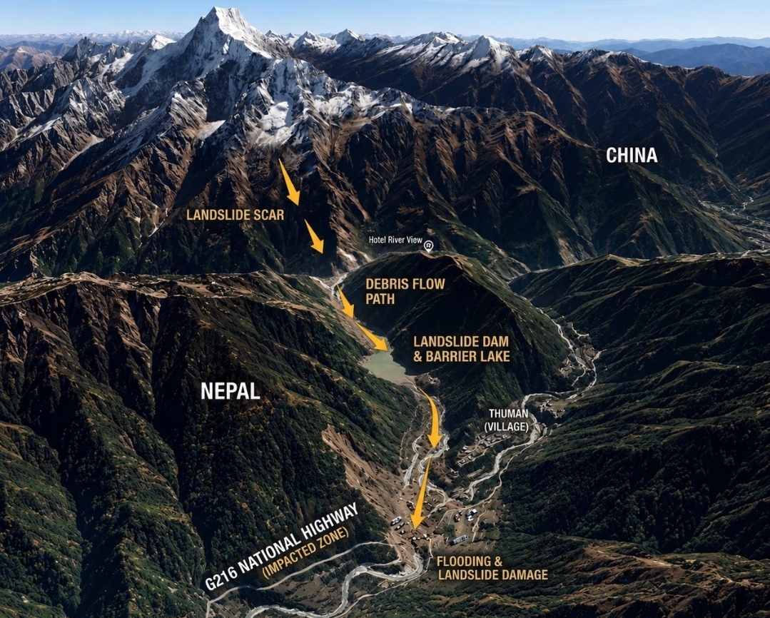
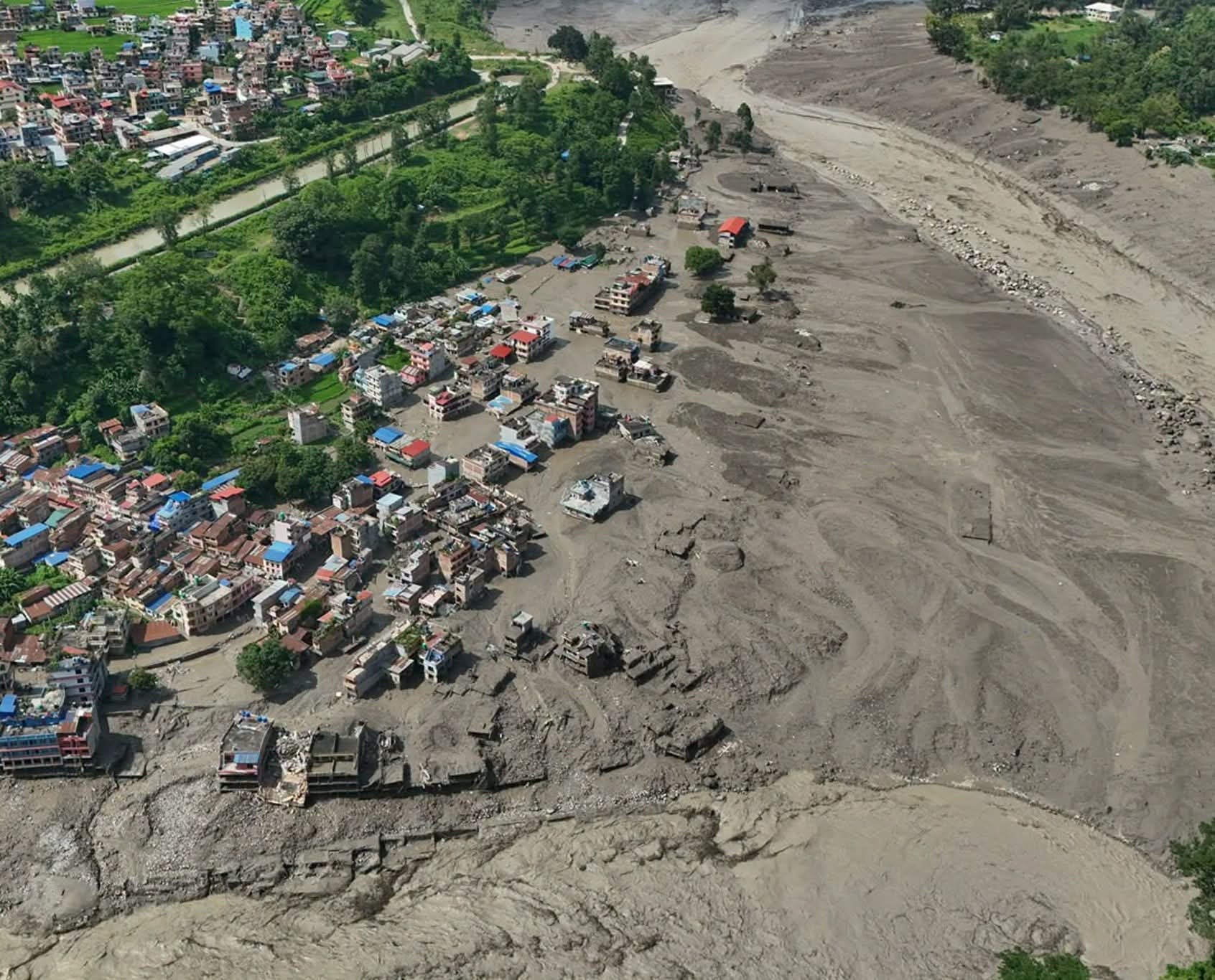
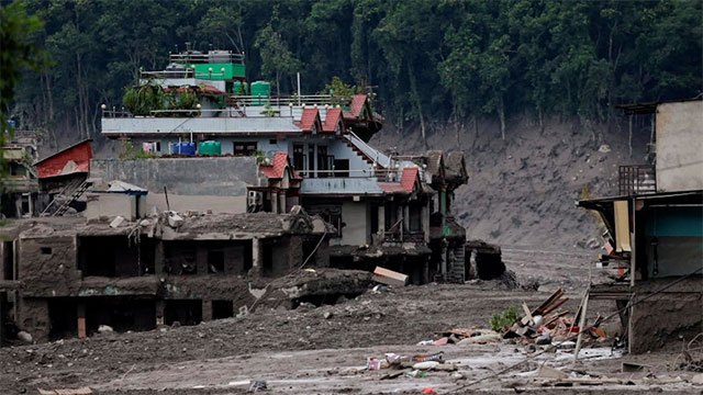
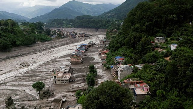
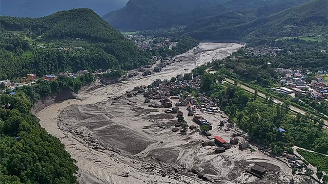
Satellite analysis by Nepal's National Disaster Risk Reduction and Management Authority indicates that a large mass of snow and rock fell into the Lhende Khola river, located around 20 kilometres northeast of the Rasuwagadhi border crossing. Scientists believe this avalanche may have temporarily blocked the river, allowing water and debris to accumulate behind the natural barrier. When this blockage eventually failed, a sudden torrent of water, mud, rocks and sediment surged downstream through the Lhende Khola and into the Bhote Koshi river system, destroying settlements, infrastructure, buildings and bridges along its path.
Authorities have cautioned that the exact sequence of events requires further verification. Investigations are ongoing into whether the earthquake destabilised the mountainous terrain and triggered the avalanche, and whether a glacial lake outburst may have also contributed to the disaster. Nepalese experts have ruled out heavy rainfall as the primary cause, noting the absence of significant precipitation in the area immediately before the flood.
Concerns remain elevated as officials have warned of continued danger. A blockage persists upstream on the Lhende Khola river, raising the possibility of another sudden flood occurring without warning.
-852538_850x460.jpg)